Find official markers near your current location
Use location-aware map and list views to turn a roadside search into nearby Texas historical markers you can actually visit.
Texas historical marker map
RoadHistorical turns 16,000+ Texas historical markers into a map-first discovery experience. Browse marker clusters before you leave, scan nearby stops from the road, and use city pages to plan history-rich detours across Texas.


Map-first discovery
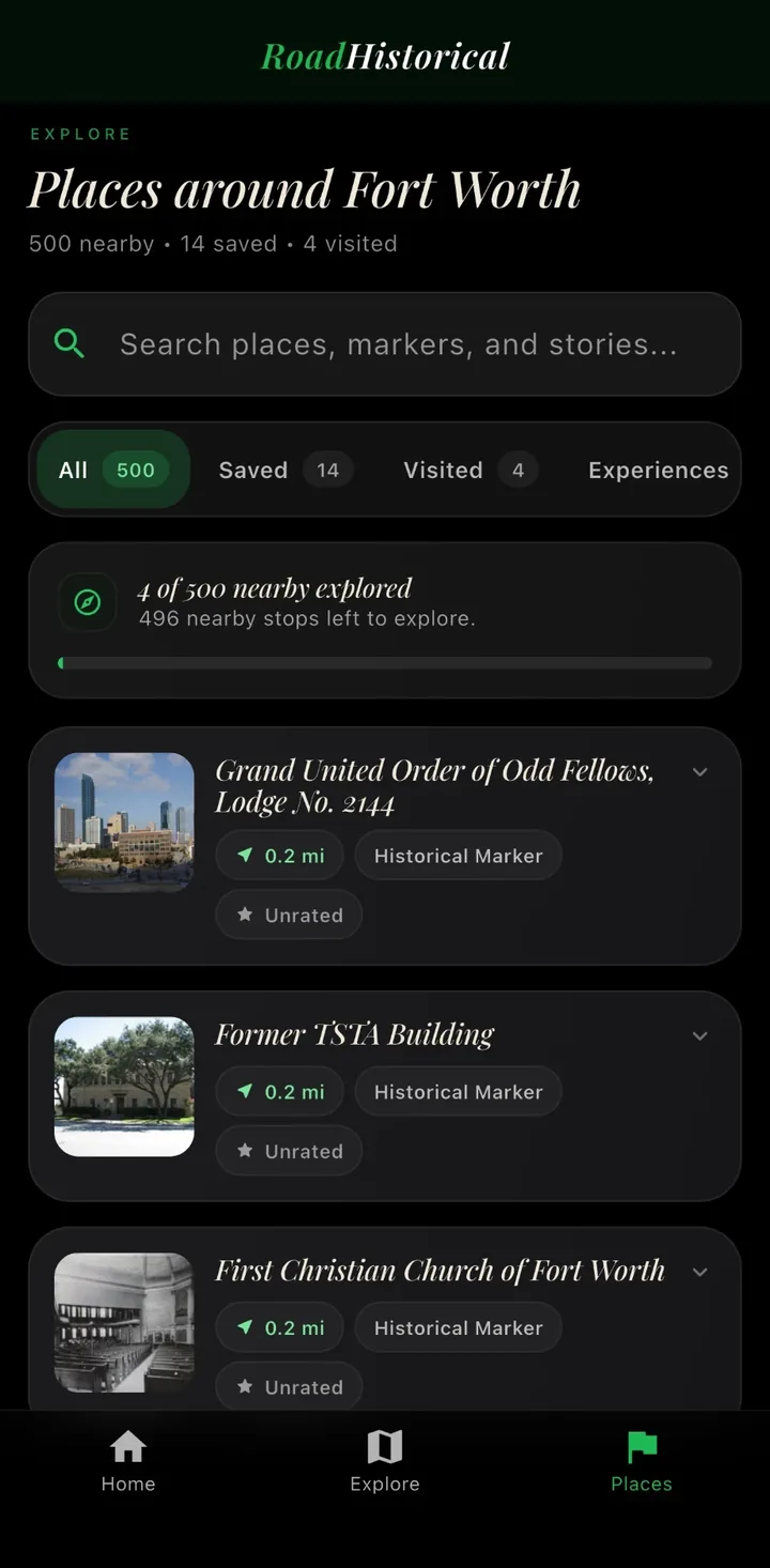
Use RoadHistorical before or during a drive to find marker density, save stops, and understand where the next useful detour sits. The app pairs map browsing with list view, audio narration, Discovery Mode, and AI Tour Guide context.
What the map does
The map is for real travel behavior: checking what is near you now, planning a city walk before dinner, scanning a courthouse square, or choosing which historic stops belong on a weekend drive.
Use location-aware map and list views to turn a roadside search into nearby Texas historical markers you can actually visit.
Scan marker density around city centers, courthouse squares, historic districts, and route-guide regions before choosing where to stop.
Open the map before you leave so the best historical-marker stops are part of the route instead of last-second discoveries.
Build a personal list of Want to Visit and Visited places so a single drive can turn into a longer Texas history trail.
Pair map discovery with audio narration when you want the story without stopping to read every word at the roadside.
Ask about people, battles, buildings, towns, and routes when the marker text gives you a lead worth following.
Historical markers near me
Open RoadHistorical, allow location access, and choose map view when you want spatial context or list view when you want the closest stops first. Before a longer drive, search the city pages and route guides on this site, then use Discovery Mode in the app so nearby markers can surface while you travel.
Browse by city
Start with major marker clusters, then branch into nearby cities and county context from each city page. RoadHistorical is strongest when the city index and the mobile map work together.
Browse by region
Plan from the map
Start with the map before you leave so you can see whether your route passes through marker-dense cities, courthouse squares, cemeteries, missions, or old highway corridors.
Zoom around your route to spot clusters of markers before committing to a detour. Dense clusters are usually better road-trip stops than isolated pins.
Bookmark markers as Want to Visit so you can build a practical stop list without deciding everything while driving.
Use Discovery Mode once you are moving so nearby markers can surface automatically instead of requiring constant map checking.
Use audio narration when you want the story without stopping long enough to read every marker detail on screen.
Use the AI Tour Guide when a marker raises a bigger question about a person, building, battle, town, or route.
Related pages
FAQ
Yes. RoadHistorical gives travelers a map-first way to browse 16,000+ Texas historical markers, preview dense marker areas, and find nearby stops while moving through Texas.
Open RoadHistorical, allow location access, and use the map or list view to see nearby Texas historical markers sorted around your current position.
Yes. RoadHistorical is free to download on iPhone and Android through the App Store and Google Play.
No. RoadHistorical is an independent app experience built for road-trip discovery. Official sources remain important for state records and research.
Yes. The website includes crawlable city pages, and the app helps you open nearby markers on the map while you travel.
Yes. RoadHistorical lets you save places for later, mark stops visited, and use progress features as you explore.
Core marker discovery uses cached marker data so the app stays useful on rural Texas roads. Some richer features, such as fresh AI context, work best with internet access.
Free to download on iPhone and Android.